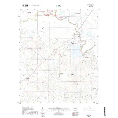
2020 Map of Calion
USGS Topo · Published 2020About this map
The Ouachita River defines the landscape of this region, meandering through a complex network of wetlands and backwaters. The town of Calion serves as a central point along the river, where the waters of Calion Lake and the Ouachita River meet near Crabapple Point. The river's influence is evident in the numerous sloughs and brakes that dot the lowlands, including Bangs Slough, Tupelo Gum Brake, and the Cross Current Slough.
Find a feature on this map
93 named features on this map. Tap any name to fly to it.
Don’t see what you’re looking for? This feature index may not catch every label — zoom into the map to look around manually.
Map Details
Editions of this 2020 Calion Map
This is the sole edition of this map. No revisions or reprints were ever made.
Other maps of this area

1927 · El Dorado
USGS Topo · 1:62,500

1930 · El Dorado
USGS Topo · 1:62,500

1933 · Strong
USGS Topo · 1:62,500

1934 · Moro Bay
USGS Topo · 1:62,500

1937 · Strong
USGS Topo · 1:62,500

1938 · Moro Bay
USGS Topo · 1:62,500

1939 · Moro Bay
USGS Topo · 1:62,500

1939 · Strong
USGS Topo · 1:62,500

1951 · El Dorado
USGS Topo · 1:62,500

1953 · El Dorado
USGS Topo · 1:250,000