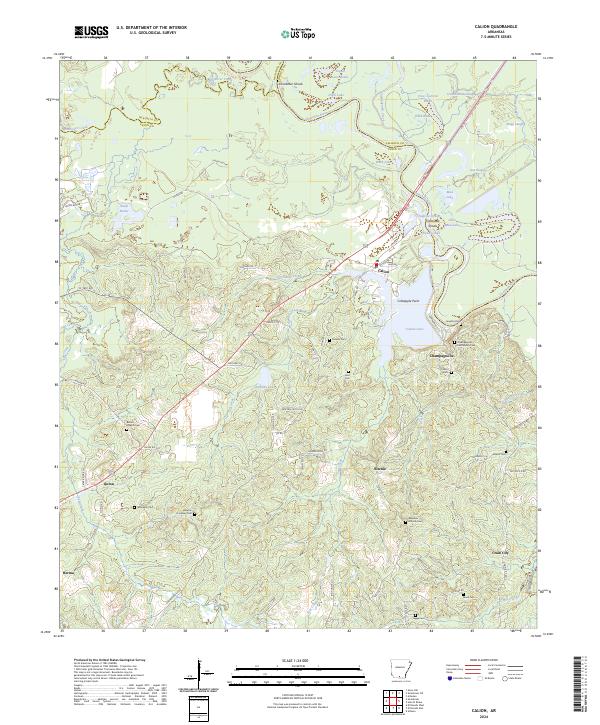
2024 Map of Calion
USGS Topo · Published 2024About this map
The Ouachita River carves a winding path through this corner of southern Arkansas, defining the boundaries between Ouachita, Union, and Calhoun counties. The landscape is heavily influenced by the river's hydrology, featuring numerous backwaters and oxbows like Babb Lake, Nickey Lake, and Cross Current Slough. Near the river's bend, the town of Calion sits adjacent to Calion Lake, while the historic settlement of Champagnolle remains a focal point for local history.
Find a feature on this map
92 named features on this map. Tap any name to fly to it.
Don’t see what you’re looking for? This feature index may not catch every label — zoom into the map to look around manually.
Map Details
Editions of this 2024 Calion Map
This is the sole edition of this map. No revisions or reprints were ever made.
Other maps of this area

1927 · El Dorado
USGS Topo · 1:62,500

1930 · El Dorado
USGS Topo · 1:62,500

1933 · Strong
USGS Topo · 1:62,500

1934 · Moro Bay
USGS Topo · 1:62,500

1937 · Strong
USGS Topo · 1:62,500

1938 · Moro Bay
USGS Topo · 1:62,500

1939 · Moro Bay
USGS Topo · 1:62,500

1939 · Strong
USGS Topo · 1:62,500

1951 · El Dorado
USGS Topo · 1:62,500

1953 · El Dorado
USGS Topo · 1:250,000