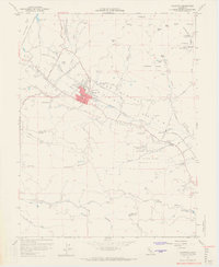
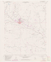
1958 Map of Calistoga
USGS Topo · Published 1965About this map
Calistoga serves as the focal point for this survey of the upper Napa Valley, showing the town’s layout before significant modern expansion. The agricultural and industrial roots of the region are clearly visible, with the Southern Pacific railroad line threading through the valley floor to serve settlements like Larkmead. Evidence of early Napa viticulture and milling history is preserved through labels for the Schramsberg Winery Historical Marker and the Bale Mill Historical Monument, while the Kellet Mine and Palisade Mine indicate the mineral interests that once shared these hillsides with the vineyards.
Find a feature on this map
68 named features on this map. Tap any name to fly to it.
Don’t see what you’re looking for? This feature index may not catch every label — zoom into the map to look around manually.
Map Details
Editions of this 1958 Calistoga Map
5 editions found
Other maps of this area

1902 · Napa
USGS Topo · 1:125,000

1916 · Santa Rosa
USGS Topo · 1:62,500

1927 · Calistoga
USGS Topo · 1:62,500

1942 · Sonoma
USGS Topo · 1:62,500

1942 · St. Helena
USGS Topo · 1:62,500

1943 · Calistoga
USGS Topo · 1:62,500

1944 · Santa Rosa
USGS Topo · 1:62,500

1945 · Calistoga
USGS Topo · 1:62,500

1945 · St. Helena
USGS Topo · 1:62,500

1947 · Santa Rosa
USGS Topo · 1:250,000