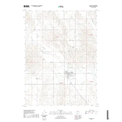
2017 Map of Callaway
USGS Topo · Published 2017About this map
Callaway sits along the South Loup River in Custer County, serving as a hub for the surrounding agricultural tablelands. The town is organized around a grid including E Pacific St and S Cameron Ave, positioned just north of Sand Cr. This 2017 survey details the integration of the river valley with the upland prairie, where names like Sand Valley and Cottonwood Creek denote the natural drainage patterns that have shaped local settlement.
Find a feature on this map
50 named features on this map. Tap any name to fly to it.
Don’t see what you’re looking for? This feature index may not catch every label — zoom into the map to look around manually.
Map Details
Editions of this 2017 Callaway Map
This is the sole edition of this map. No revisions or reprints were ever made.
Other maps of this area

1951 · Callaway NW
USGS Topo · 1:24,000

1951 · Merna
USGS Topo · 1:24,000

1951 · Callaway SE
USGS Topo · 1:24,000

1951 · Callaway
USGS Topo · 1:24,000

1951 · Oconto NW
USGS Topo · 1:24,000

1951 · Oconto
USGS Topo · 1:24,000

1954 · North Platte
USGS Topo · 1:250,000

1955 · Broken Bow
USGS Topo · 1:250,000

1956 · Broken Bow
USGS Topo · 1:250,000

1956 · North Platte
USGS Topo · 1:250,000