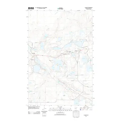
2013 Map of Calumet
USGS Topo · Published 2013About this map
Taconite, Marble, and Calumet form a string of settlements along the Us-169 corridor, reflecting the industrial legacy of the Mesabi Iron Range. The landscape is profoundly shaped by extraction, visible in the complex hydrology of the Trout Lake Tailings Basin, Hill Annex Pond One, and the Lower Panaca Lake reservoirs. Between these industrial features, natural water bodies like Big Diamond Lake and Holman Lake remain, while the Swan River meanders through the southern portion of the quadrangle. Local landmarks such as Sal's Campground and the small community of Silverwood provide a detailed look at the rural character of Greenway Township during the early 21st century.
Find a feature on this map
50 named features on this map. Tap any name to fly to it.
Don’t see what you’re looking for? This feature index may not catch every label — zoom into the map to look around manually.
Map Details
Editions of this 2013 Calumet Map
This is the sole edition of this map. No revisions or reprints were ever made.
Other maps of this area

1920 · Trout Lake
USGS Topo · 1:62,500

1952 · Nashwauk
USGS Topo · 1:24,000

1952 · Calumet
USGS Topo · 1:24,000

1952 · Pengilly
USGS Topo · 1:24,000

1952 · Bovey
USGS Topo · 1:24,000

1954 · Hibbing
USGS Topo · 1:250,000

1957 · Hibbing
USGS Topo · 1:250,000

1958 · Hibbing
USGS Topo · 1:250,000

1964 · Hibbing
USGS Topo · 1:250,000

1969 · La Prairie
USGS Topo · 1:24,000