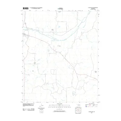
2010 Map of Calvin East
USGS Topo · Published 2010About this map
The Canadian River cuts a wide path through this Oklahoma landscape, defining the topography east of the town of Calvin. This 2010 survey illustrates a rural region characterized by a dense network of watercourses, including Salt Creek, Peach Creek, and Shawnee Creek, which feed into the primary river valley. Named landmarks like the Lindley Robertson Dam and Stanley Huser Dam indicate local water management and agricultural engineering. For those researching local heritage, the map identifies significant sites such as the Spring Creek Cemetery in the north and the Blue Ridge Cemetery further south. The presence of Lobo Field and the Stuart Mountain Airpark reflects the continued use of small-scale aviation infrastructure within these Hughes County ranchlands and farms.
Find a feature on this map
30 named features on this map. Tap any name to fly to it.
Don’t see what you’re looking for? This feature index may not catch every label — zoom into the map to look around manually.
Map Details
Editions of this 2010 Calvin East Map
This is the sole edition of this map. No revisions or reprints were ever made.
Other maps of this area

1896 · Coalgate
USGS Topo · 1:125,000

1899 · Coalgate
USGS Topo · 1:125,000

1900 · Wewoka
USGS Topo · 1:125,000

1900 · Coalgate
USGS Topo · 1:125,000

1954 · Oklahoma City
USGS Topo · 1:250,000

1957 · Ardmore
USGS Topo · 1:250,000

1957 · Oklahoma City
USGS Topo · 1:250,000

1963 · Ardmore
USGS Topo · 1:250,000

1963 · Oklahoma City
USGS Topo · 1:250,000

1967 · Calvin East
USGS Topo · 1:24,000