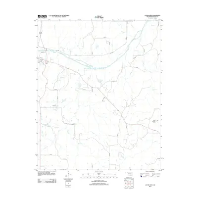
2012 Map of Calvin East
USGS Topo · Published 2012About this map
The Canadian River meanders across this eastern Oklahoma landscape, shaping the local topography of Hughes County. In the northwest corner, the residential grid of Calvin is centered around Walnut St and numbered streets like 1st St and 5th St. This 2012 survey illustrates a transition from the structured town blocks to a expansive rural network of section-line roads, such as E1410 Rd and N3840 Rd. Local history and genealogy are anchored by two significant burial grounds, Blue Ridge Cem and Hill Top Cem, which remain as permanent markers of the area's development.
Find a feature on this map
41 named features on this map. Tap any name to fly to it.
Don’t see what you’re looking for? This feature index may not catch every label — zoom into the map to look around manually.
Map Details
Editions of this 2012 Calvin East Map
This is the sole edition of this map. No revisions or reprints were ever made.
Other maps of this area

1896 · Coalgate
USGS Topo · 1:125,000

1899 · Coalgate
USGS Topo · 1:125,000

1900 · Wewoka
USGS Topo · 1:125,000

1900 · Coalgate
USGS Topo · 1:125,000

1954 · Oklahoma City
USGS Topo · 1:250,000

1957 · Ardmore
USGS Topo · 1:250,000

1957 · Oklahoma City
USGS Topo · 1:250,000

1963 · Ardmore
USGS Topo · 1:250,000

1963 · Oklahoma City
USGS Topo · 1:250,000

1967 · Calvin East
USGS Topo · 1:24,000