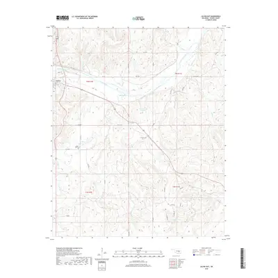
2018 Map of Calvin East
USGS Topo · Published 2018About this map
Calvin anchors the northwest corner of this Hughes County landscape, where the wide valley of the Canadian River cuts eastward through the terrain. The area is defined by a dense network of tributaries including Salt Cr, Jointer Cr, and Spring Cr that feed into the river's basin. To the south, the Stanley Hussey Reservoir collect waters near several local landmarks such as Hill Top Cem, which sits on a high point overlooking the valley. The map reveals a rural structure of section roads like Ew 141 and NS 381 RD that connect the community of Calvin to outlying areas near Blue Ridge Cem. This documentation shows the late 2010s balance of managed water resources and traditional cemeteries that define the local geography south of the river.
Find a feature on this map
44 named features on this map. Tap any name to fly to it.
Don’t see what you’re looking for? This feature index may not catch every label — zoom into the map to look around manually.
Map Details
Editions of this 2018 Calvin East Map
This is the sole edition of this map. No revisions or reprints were ever made.
Other maps of this area

1896 · Coalgate
USGS Topo · 1:125,000

1899 · Coalgate
USGS Topo · 1:125,000

1900 · Wewoka
USGS Topo · 1:125,000

1900 · Coalgate
USGS Topo · 1:125,000

1954 · Oklahoma City
USGS Topo · 1:250,000

1957 · Ardmore
USGS Topo · 1:250,000

1957 · Oklahoma City
USGS Topo · 1:250,000

1963 · Ardmore
USGS Topo · 1:250,000

1963 · Oklahoma City
USGS Topo · 1:250,000

1967 · Calvin East
USGS Topo · 1:24,000