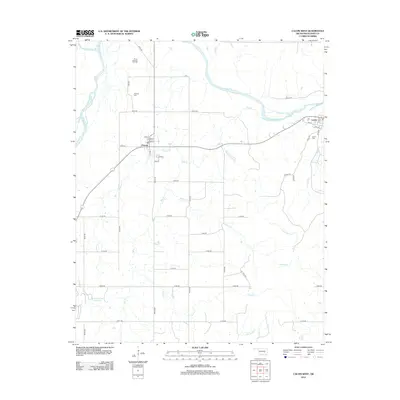
2012 Map of Calvin West
USGS Topo · Published 2012About this map
The Canadian River and Little River converge in this section of Hughes County, defining a landscape of riparian lowlands and uplands marked by rural industry. The North Atwood Oil Field dominates the northern terrain, indicating the persistent importance of energy extraction in the region. Settlement centers are concentrated at Atwood and the western edge of Calvin, where established street grids like Avenue D and Broadway meet rural routes. For those researching local lineages, the Atwood Cem and Calvin Cem are preserved landmarks within their respective communities. Numerous tributaries, including Wildcat Cr and Leader Cr, lace the southern half of the map, draining into the Kenneth W Reservoir, a notable water feature that reshaped the local drainage patterns near Gerty Rd.
Find a feature on this map
51 named features on this map. Tap any name to fly to it.
Don’t see what you’re looking for? This feature index may not catch every label — zoom into the map to look around manually.
Map Details
Editions of this 2012 Calvin West Map
This is the sole edition of this map. No revisions or reprints were ever made.
Other maps of this area

1896 · Coalgate
USGS Topo · 1:125,000

1899 · Coalgate
USGS Topo · 1:125,000

1900 · Wewoka
USGS Topo · 1:125,000

1900 · Coalgate
USGS Topo · 1:125,000

1954 · Oklahoma City
USGS Topo · 1:250,000

1957 · Ardmore
USGS Topo · 1:250,000

1957 · Oklahoma City
USGS Topo · 1:250,000

1958 · Steedman
USGS Topo · 1:24,000

1963 · Ardmore
USGS Topo · 1:250,000

1963 · Oklahoma City
USGS Topo · 1:250,000