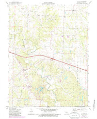
1973 Map of Calwood
USGS Topo · Published 1986About this map
Auxvasse Creek and its many tributaries, including Harrison Branch, Hurt Branch, and Clarks Branch, carve through the rural landscape of central Callaway County. This 1970s survey captures a transition in land use, showing established agricultural townships alongside newer recreational developments like Leisure Lake. The mapping reveals a high density of rural institutions that anchored these small communities, such as Old Auxvasse Ch, Harmony Ch, and New Hope Ch.
Find a feature on this map
27 named features on this map. Tap any name to fly to it.
Don’t see what you’re looking for? This feature index may not catch every label — zoom into the map to look around manually.
Map Details
Editions of this 1973 Calwood Map
2 editions found
Other maps of this area

1890 · Mexico
USGS Topo · 1:125,000

1890 · Fulton
USGS Topo · 1:125,000

1928 · Fulton
USGS Topo · 1:62,500

1931 · Fulton
USGS Topo · 1:62,500

1932 · Mexico
USGS Topo · 1:62,500

1940 · Montgomery City
USGS Topo · 1:62,500

1942 · Montgomery City
USGS Topo · 1:62,500

1942 · Wellsville
USGS Topo · 1:62,500

1948 · Quincy
USGS Topo · 1:250,000

1949 · Saint Louis
USGS Topo · 1:250,000