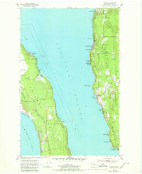
1953 Map of Camano
USGS Topo · Published 1980About this map
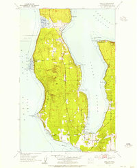
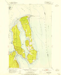
Saratoga Passage separates the residential shores of Camano Island from the military and agricultural landscape of Whidbey Island in this early 1950s survey. On the Whidbey side, the Whidbey Island Naval Air Station occupies the western edge, adjacent to Smith Prairie, while the eastern shoreline is marked by the distinct natural features of Harrington Lagoon and Race Lagoon. Across the water, the western face of Camano Island is a dense series of coastal settlements and summer destinations, including Madrona Beach, Sunset Beach, and Cama Beach. Inland, the terrain is defined by a network of local roads such as Poggensee Road and Vining Road, which connected scattered farms and homesteads before the further development of Camano Island State Park at the southern tip.
Find a feature on this map
33 named features on this map. Tap any name to fly to it.
Don’t see what you’re looking for? This feature index may not catch every label — zoom into the map to look around manually.
Map Details
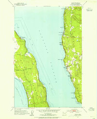
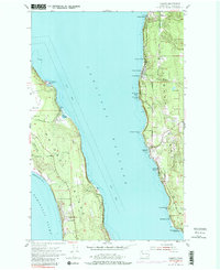
Editions of this 1953 Camano Map
4 editions found

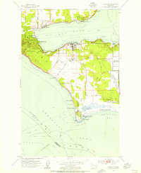
Other maps of this area

1911 · Mount Vernon
USGS Topo · 1:125,000

1939 · Coupeville
USGS Topo · 1:62,500

1940 · Mt Vernon
USGS Topo · 1:62,500

1943 · Mt Vernon
USGS Topo · 1:62,500

1943 · Stanwood
USGS Topo · 1:62,500

1943 · Deception Pass
USGS Topo · 1:62,500

1951 · Deception Pass
USGS Topo · 1:62,500
1953 · Coupeville
USGS Topo · 1:24,000
1953 · Freeland
USGS Topo · 1:24,000
1953 · Nordland
USGS Topo · 1:24,000