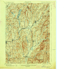
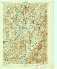
1901 Map of Cambridge
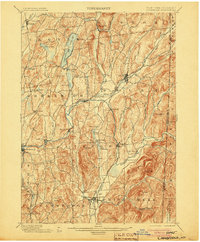
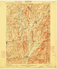
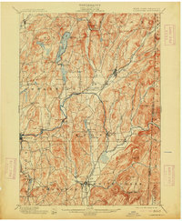
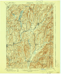
USGS Topo · Published 1927About this map
The winding course of the Batten Kill anchors this late nineteenth-century survey of Washington County, flowing through established hamlets like Battenville, Center Falls, and Shushan. The landscape is defined by the sharp transition between the agricultural valley floor and the prominent heights of Hebron Mt. and Two Tops. To the north, Cossayuna Lake serves as a major geographical landmark, while the southern reaches center on the junction at Cambridge.
Find a feature on this map
68 named features on this map. Tap any name to fly to it.
Don’t see what you’re looking for? This feature index may not catch every label — zoom into the map to look around manually.
Map Details
Editions of this 1901 Cambridge Map
8 editions found


Other maps of this area

1893 · Cohoes
USGS Topo · 1:62,500

1893 · Fort Ann
USGS Topo · 1:62,500

1894 · Pawlet
USGS Topo · 1:62,500

1894 · Equinox
USGS Topo · 1:62,500

1895 · Cohoes
USGS Topo · 1:62,500

1895 · Cambridge
USGS Topo · 1:62,500

1895 · Fort Ann
USGS Topo · 1:62,500

1895 · Glens Falls
USGS Topo · 1:62,500

1896 · Equinox
USGS Topo · 1:62,500

1897 · Pawlet
USGS Topo · 1:62,500