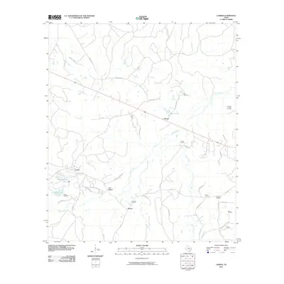
2010 Map of Camden
USGS Topo · Published 2010About this map
Camden and the surrounding pine-draped landscapes of East Texas are documented in this detailed 2010 survey. The settlement of Barnum and the historic site of Old Barnum suggest a shift in local habitation patterns near Barnum Lake. For genealogists, the map is remarkably dense with burial sites, including Peach Tree Village Cemetery, Darden Cemetery, and Lily Island Cemetery, reflecting the deep-rooted family networks of the area.
Find a feature on this map
55 named features on this map. Tap any name to fly to it.
Don’t see what you’re looking for? This feature index may not catch every label — zoom into the map to look around manually.
Map Details
Editions of this 2010 Camden Map
This is the sole edition of this map. No revisions or reprints were ever made.
Other maps of this area

1927 · Lufkin 4-c
USGS Topo · 1:24,000

1928 · Lufkin 4-d
USGS Topo · 1:24,000

1932 · Manning
USGS Topo · 1:62,500

1953 · Palestine
USGS Topo · 1:250,000

1954 · Beaumont
USGS Topo · 1:250,000

1955 · Camden
USGS Topo · 1:62,500

1955 · New Willard
USGS Topo · 1:62,500

1957 · Beaumont
USGS Topo · 1:250,000

1957 · Palestine
USGS Topo · 1:250,000
1963 · Wolf Hill
USGS Topo · 1:24,000