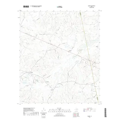
2019 Map of Camden
USGS Topo · Published 2019About this map
Lily Island and the small settlement of Barnum anchor this map of East Texas, where the landscape is defined by the winding paths of Elm Cr and Dabbs Cr. The area is characterized by scattered family settlements and an unusually high density of burial grounds, including the Peach Tree Village Cem and Nowlin Cem, which offer significant value for genealogical research. The Tyler County and Polk County line runs vertically through the eastern portion of the sheet, dividing a region shaped by local thoroughfares like Neals Fwy and the older Old Barnum Rd. The presence of landmarks such as Conley's Corner and Carter Lake suggests a community organized around family holdings and natural water resources, typical of this timber-rich region.
Find a feature on this map
76 named features on this map. Tap any name to fly to it.
Don’t see what you’re looking for? This feature index may not catch every label — zoom into the map to look around manually.
Map Details
Editions of this 2019 Camden Map
This is the sole edition of this map. No revisions or reprints were ever made.
Other maps of this area

1927 · Lufkin 4-c
USGS Topo · 1:24,000

1928 · Lufkin 4-d
USGS Topo · 1:24,000

1932 · Manning
USGS Topo · 1:62,500

1953 · Palestine
USGS Topo · 1:250,000

1954 · Beaumont
USGS Topo · 1:250,000

1955 · Camden
USGS Topo · 1:62,500

1955 · New Willard
USGS Topo · 1:62,500

1957 · Beaumont
USGS Topo · 1:250,000

1957 · Palestine
USGS Topo · 1:250,000
1963 · Wolf Hill
USGS Topo · 1:24,000