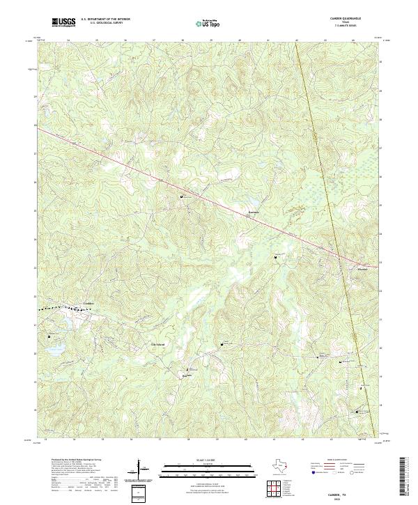
2022 Map of Camden
USGS Topo · Published 2022About this map
Camden and the surrounding piney woods of East Texas are defined by a complex network of creeks and small settlements in this modern survey. The landscape is bisected by the Neals Fwy, which connects the communities of Barnum and Chester across the northern reaches of the quadrangle. A distinct concentration of family history is found in the numerous burial grounds scattered throughout the timberlands, including the Pullen - Davis - Toney Family Cem and the Davis Cem At Caney Creek near the border of Tyler and Polk counties.
Find a feature on this map
80 named features on this map. Tap any name to fly to it.
Don’t see what you’re looking for? This feature index may not catch every label — zoom into the map to look around manually.
Map Details
Editions of this 2022 Camden Map
This is the sole edition of this map. No revisions or reprints were ever made.
Other maps of this area

1927 · Lufkin 4-c
USGS Topo · 1:24,000

1928 · Lufkin 4-d
USGS Topo · 1:24,000

1932 · Manning
USGS Topo · 1:62,500

1953 · Palestine
USGS Topo · 1:250,000

1954 · Beaumont
USGS Topo · 1:250,000

1955 · Camden
USGS Topo · 1:62,500

1955 · New Willard
USGS Topo · 1:62,500

1957 · Beaumont
USGS Topo · 1:250,000

1957 · Palestine
USGS Topo · 1:250,000
1963 · Wolf Hill
USGS Topo · 1:24,000