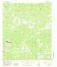
1984 Map of Camden
USGS Topo · Published 1984About this map
Camden and its industrial layout define the western portion of this 1980s-era survey, situated near the border of Polk and Tyler counties. The landscape is deeply etched by a network of waterways, including Caney Creek, Sulphur Creek, and the winding Beaver Creek in the northwest. These drainages create a complex topography of ridges and bottoms, notably around the distinct landform known as Lily Island near Dobbs Creek.
Find a feature on this map
19 named features on this map. Tap any name to fly to it.
Don’t see what you’re looking for? This feature index may not catch every label — zoom into the map to look around manually.
Map Details
Editions of this 1984 Camden Map
This is the sole edition of this map. No revisions or reprints were ever made.
Other maps of this area

1927 · Lufkin 4-c
USGS Topo · 1:24,000

1928 · Lufkin 4-d
USGS Topo · 1:24,000

1932 · Manning
USGS Topo · 1:62,500

1953 · Palestine
USGS Topo · 1:250,000

1954 · Beaumont
USGS Topo · 1:250,000

1955 · Camden
USGS Topo · 1:62,500

1955 · New Willard
USGS Topo · 1:62,500

1957 · Beaumont
USGS Topo · 1:250,000

1957 · Palestine
USGS Topo · 1:250,000
1963 · Wolf Hill
USGS Topo · 1:24,000