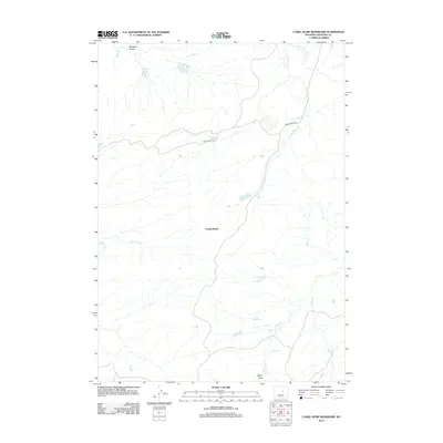
2012 Map of Camel Hump Reservoir
USGS Topo · Published 2012About this map
Camel Hump rises above a high-desert landscape in Natrona County, where human intervention in the arid terrain is defined by a network of water catchment systems. The 2012 geography shows several essential basins, including Camel Hump Reservoir, Wild Horse Reservoir, and the appropriately named Leg Reservoir, which provide vital water sources for local livestock or wildlife. These reservoirs are connected by a sparse infrastructure of drainages such as N Fork Dead Horse Cr and Lone Tree Cr. Movement through this area is restricted to a few established routes like the Wild Horse Trl and Long Canyon Rd. The map illustrates a classic Wyoming ranching or grazing landscape where the location of every Bayer Draw and Meadow Gulch is critical for navigation and land use.
Find a feature on this map
13 named features on this map. Tap any name to fly to it.
Don’t see what you’re looking for? This feature index may not catch every label — zoom into the map to look around manually.
Map Details
Editions of this 2012 Camel Hump Reservoir Map
This is the sole edition of this map. No revisions or reprints were ever made.
Other maps of this area

1955 · Arminto
USGS Topo · 1:250,000

1958 · Arminto
USGS Topo · 1:250,000

1962 · Arminto
USGS Topo · 1:250,000

1968 · Big Gulch
USGS Topo · 1:24,000

1968 · Merino
USGS Topo · 1:24,000
1968 · Statzer Point
USGS Topo · 1:24,000

1968 · Camel Hump Reservoir
USGS Topo · 1:24,000

1968 · Reynolds Reservoir
USGS Topo · 1:24,000

1968 · Fiftymile Flat
USGS Topo · 1:24,000

1968 · Salt Canyon
USGS Topo · 1:24,000