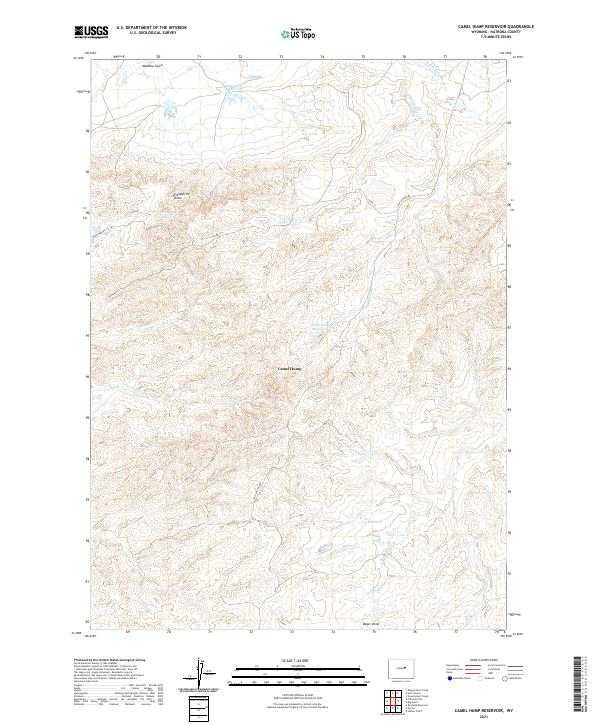
2021 Map of Camel Hump Reservoir
USGS Topo · Published 2021About this map
Camel Hump rises as the central landmark in this high plains landscape of northern Natrona County, where a network of ephemeral drainages and reservoirs defines the rural geography. The terrain is carved by deep seasonal courses like Fitzpatrick Draw and Bayer Draw, which feed into larger systems such as Dead Horse Cr and Castle Cr. Human presence is marked by isolated water management sites, including Camel Hump Reservoir, Wild Horse Reservoir, and Leg Reservoir, essential for ranching operations in this arid region.
Find a feature on this map
19 named features on this map. Tap any name to fly to it.
Don’t see what you’re looking for? This feature index may not catch every label — zoom into the map to look around manually.
Map Details
Editions of this 2021 Camel Hump Reservoir Map
This is the sole edition of this map. No revisions or reprints were ever made.
Other maps of this area

1955 · Arminto
USGS Topo · 1:250,000

1958 · Arminto
USGS Topo · 1:250,000

1962 · Arminto
USGS Topo · 1:250,000

1968 · Big Gulch
USGS Topo · 1:24,000

1968 · Merino
USGS Topo · 1:24,000
1968 · Statzer Point
USGS Topo · 1:24,000

1968 · Camel Hump Reservoir
USGS Topo · 1:24,000

1968 · Reynolds Reservoir
USGS Topo · 1:24,000

1968 · Fiftymile Flat
USGS Topo · 1:24,000

1968 · Salt Canyon
USGS Topo · 1:24,000