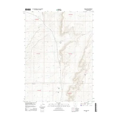
2015 Map of Camel Rock
USGS Topo · Published 2015About this map
Camel Rock stands as a landmark in this high desert landscape of Sweetwater County, where the hydrology is defined by seasonal drainages like Salt Wells Cr and No Name Cr. This 2015 survey illustrates a terrain of significant elevation changes, particularly along the eastern boundary where Cooper Ridge provides a dominant overlook. The road network is primarily industrial or rural in nature, with Salt Wells Rd and Brady Field Rd cutting through the open country to serve local access and land management needs. Numerous named erosional features, including Cutthroat Draw, Station Draw, and Antelope Draw, reveal the intricate drainage patterns that have shaped this portion of the Wyoming Basin. While largely devoid of permanent settlements, the map documents a vital landscape of natural springs such as Snow Spring Cr and Spring Cr.
Find a feature on this map
18 named features on this map. Tap any name to fly to it.
Don’t see what you’re looking for? This feature index may not catch every label — zoom into the map to look around manually.
Map Details
Editions of this 2015 Camel Rock Map
This is the sole edition of this map. No revisions or reprints were ever made.
Other maps of this area

1908 · Rock Springs
USGS Topo · 1:62,500

1910 · Rock Springs
USGS Topo · 1:62,500

1954 · Rock Springs
USGS Topo · 1:250,000

1958 · Rock Springs
USGS Topo · 1:250,000

1962 · Rock Springs
USGS Topo · 1:250,000

1968 · Cooper Ridge NE
USGS Topo · 1:24,000

1968 · Point Of Rocks SW
USGS Topo · 1:24,000

1968 · Mud Springs Ranch
USGS Topo · 1:24,000
1968 · South Baxter
USGS Topo · 1:24,000

1968 · Camel Rock
USGS Topo · 1:24,000