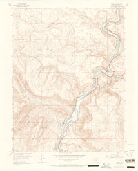
1955 Map of Cameo
USGS Topo · Published 1965About this map
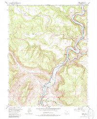
Colorado River hydraulics and industrial infrastructure dominate this mid-century survey of the rugged De Beque Canyon corridor. The settlement of Cameo serves as a focal point for the region's energy and transport networks, featuring a Power Plant, a Mine, and Cameo Siding along the Denver and Rio Grande Western railroad. The map meticulously documents the complex water management systems essential to the area, including the Grand Valley Diversion Dam, the Government Highline Canal, and the Orchard Mesa Siphon. High terrain features such as Mount Lincoln and Bunkwater Ridge overlook the winding river valley. These engineering details, from the Gaging Sta to various tunnels and cables, illustrate the intensive mid-century efforts to harness the river for power and irrigation in Mesa County's challenging topography.
Find a feature on this map
33 named features on this map. Tap any name to fly to it.
Don’t see what you’re looking for? This feature index may not catch every label — zoom into the map to look around manually.
Map Details
Editions of this 1955 Cameo Map
6 editions found
Other maps of this area

1929 · Grand Valley
USGS Topo · 1:62,500

1929 · Roan Creek
USGS Topo · 1:62,500

1955 · Cameo
USGS Topo · 1:24,000

1955 · Mesa
USGS Topo · 1:24,000

1956 · Grand Junction
USGS Topo · 1:250,000

1959 · Grand Junction
USGS Topo · 1:250,000

1960 · Grand Junction
USGS Topo · 1:250,000

1962 · Grand Junction
USGS Topo · 1:250,000

1962 · Clifton
USGS Topo · 1:24,000
1962 · De Beque
USGS Topo · 1:24,000