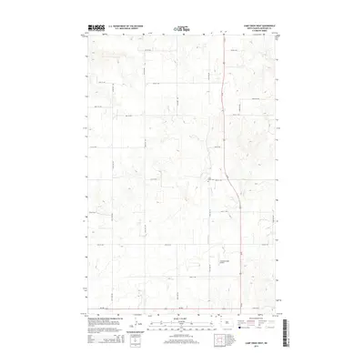
2014 Map of Camp Creek West
USGS Topo · Published 2014About this map
Camp Creek winds through the high plains of western McKenzie County, defining the drainage patterns of this sparsely settled landscape. The intersection of Us-85 and ND-200 serves as the primary transit corridor, anchoring a network of section-line roads that includes 32nd St NW and 144th Ave NW. This 2014 survey reveals a region shaped by agricultural geometry and modern aviation, where the small Gajewski Field Airport sits as a quiet landmark amidst the vast grid of range roads. For those researching local history or land use, the presence of the Camp Creek Cem provides a specific point of reference for the families who established themselves in this pocket of North Dakota. The map captures the era just as modern infrastructure began to intensify in the region, preserving the names and locations of long-standing rural landmarks.
Find a feature on this map
21 named features on this map. Tap any name to fly to it.
Don’t see what you’re looking for? This feature index may not catch every label — zoom into the map to look around manually.
Map Details
Editions of this 2014 Camp Creek West Map
This is the sole edition of this map. No revisions or reprints were ever made.
Other maps of this area

1953 · Williston
USGS Topo · 1:250,000

1953 · Watford City
USGS Topo · 1:250,000

1957 · Williston
USGS Topo · 1:250,000

1957 · Watford City
USGS Topo · 1:250,000

1967 · Watford City
USGS Topo · 1:250,000

1969 · Trenton
USGS Topo · 1:24,000

1969 · Cartwright NE
USGS Topo · 1:24,000

1972 · Alexander
USGS Topo · 1:24,000

1972 · Rawson
USGS Topo · 1:24,000

1972 · Charbonneau
USGS Topo · 1:24,000