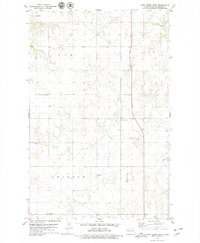
1978 Map of Camp Creek West
USGS Topo · Published 1979About this map
The drainage of Camp Creek carves a complex network of coulees across this 1970s landscape in McKenzie County. The map captures a rural community defined by its township boundaries and spiritual centers, such as St Olaf Ch and the Camp Creek Cem. Aviation markers including Taylor Landing Field and the private Gajewski Landing Strip indicate how these isolated prairie settlements connected with the wider region. In the south, a local Townhall stands as a civic landmark, while a Pipeline and a Gravel Pit reflect the infrastructure and industrial activities shaping the plains during this era. This survey provides a precise record of section lines and the intricate topography of the North Dakota badlands before later developments.
Find a feature on this map
11 named features on this map. Tap any name to fly to it.
Don’t see what you’re looking for? This feature index may not catch every label — zoom into the map to look around manually.
Map Details
Editions of this 1978 Camp Creek West Map
This is the sole edition of this map. No revisions or reprints were ever made.
Other maps of this area

1953 · Williston
USGS Topo · 1:250,000

1953 · Watford City
USGS Topo · 1:250,000

1957 · Williston
USGS Topo · 1:250,000

1957 · Watford City
USGS Topo · 1:250,000

1967 · Watford City
USGS Topo · 1:250,000

1969 · Trenton
USGS Topo · 1:24,000

1969 · Cartwright NE
USGS Topo · 1:24,000

1972 · Alexander
USGS Topo · 1:24,000

1972 · Rawson
USGS Topo · 1:24,000

1972 · Charbonneau
USGS Topo · 1:24,000