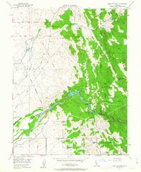
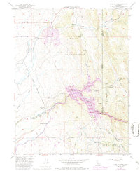
1949 Map of Camp Far West
USGS Topo · Published 1963About this map
Bear River serves as the focal point for this landscape along the borders of Yuba, Nevada, and Placer counties, just before mid-century hydraulic changes reshaped the valley. The map documents a period of transition where the Camp Beale Military Reservation dominates the northern terrain, overlaying the older boundaries of the Rancho Johnson land grant. Local industry and early pioneer history are clearly visible at the Dairy Farm Mine and the Camp Far West (Historic Site), a former military post established during the gold rush era. South of the Camp Far West Reservoir, the landscape shifts toward the agricultural settlements of The Thermalands, where the Valley View School and Lofton Cem provide critical touchstones for genealogical research. The presence of significant Tailings along the riverbanks underscores the lasting impact of mining on the local topography.
Find a feature on this map
33 named features on this map. Tap any name to fly to it.
Don’t see what you’re looking for? This feature index may not catch every label — zoom into the map to look around manually.
Map Details
Editions of this 1949 Camp Far West Map
5 editions found
Other maps of this area

1888 · Smartsville
USGS Topo · 1:125,000

1891 · Sacramento
USGS Topo · 1:125,000

1891 · Smartsville
USGS Topo · 1:125,000

1892 · Sacramento
USGS Topo · 1:125,000

1892 · Smartsville
USGS Topo · 1:125,000

1893 · Sacramento
USGS Topo · 1:125,000

1894 · Smartsville
USGS Topo · 1:125,000

1895 · Smartsville
USGS Topo · 1:125,000

1910 · Sheridan
USGS Topo · 1:31,680

1910 · Lincoln
USGS Topo · 1:31,680