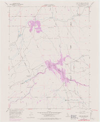
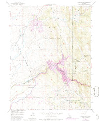
1949 Map of Camp Far West
USGS Topo · Published 1976About this map
Beale Air Force Base dominates the northern landscape of this region, illustrating the mid-century military footprint in the foothills of the Sierra Nevada. The map captures a transitional moment for the Bear River drainage, specifically identifying the Camp Far West Reservoir and its associated spillway and canals. This hydro-infrastructure overlays a deeper pioneer history, marked by the Camp Far West (Historic Site) and the Camp Far West Ranch near the riverbank.
Find a feature on this map
23 named features on this map. Tap any name to fly to it.
Don’t see what you’re looking for? This feature index may not catch every label — zoom into the map to look around manually.
Map Details
Editions of this 1949 Camp Far West Map
5 editions found
Other maps of this area

1888 · Smartsville
USGS Topo · 1:125,000

1891 · Sacramento
USGS Topo · 1:125,000

1891 · Smartsville
USGS Topo · 1:125,000

1892 · Sacramento
USGS Topo · 1:125,000

1892 · Smartsville
USGS Topo · 1:125,000

1893 · Sacramento
USGS Topo · 1:125,000

1894 · Smartsville
USGS Topo · 1:125,000

1895 · Smartsville
USGS Topo · 1:125,000

1910 · Sheridan
USGS Topo · 1:31,680

1910 · Lincoln
USGS Topo · 1:31,680