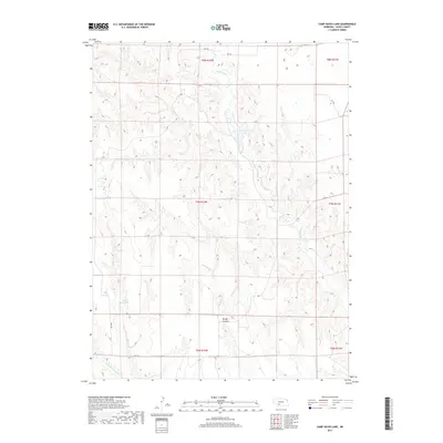
2017 Map of Camp Hayes Lake
USGS Topo · Published 2017About this map
Red Willow Cr meanders through the heart of this Hayes County landscape, feeding into the prominent Camp Hayes Lake. The terrain is defined by the sharp incisions of local drainages, most notably the wide corridor of Burger Canyon in the south and the winding path of Skunk Cr to the west. This 2017 survey reflects a largely agricultural and pastoral region, where water management is critical to the local economy, as evidenced by the presence of the Lelker Reservoir. Transportation is maintained through a network of rural routes such as RD 745 and 372 Ave, which follow the section lines characteristic of the Great Plains' public land survey system. The map captures the quiet, hydraulic character of the Nebraska high plains, where small tributaries like Little Blackwood Cr drain the breaks between open tablelands.
Find a feature on this map
17 named features on this map. Tap any name to fly to it.
Don’t see what you’re looking for? This feature index may not catch every label — zoom into the map to look around manually.
Map Details
Editions of this 2017 Camp Hayes Lake Map
This is the sole edition of this map. No revisions or reprints were ever made.
Other maps of this area

1954 · McCook
USGS Topo · 1:250,000

1956 · White NE
USGS Topo · 1:24,000

1957 · McCook
USGS Topo · 1:250,000

1958 · McCook
USGS Topo · 1:250,000

1970 · Burger Canyon East
USGS Topo · 1:24,000

1973 · Camp Hayes Lake SE
USGS Topo · 1:24,000

1973 · Suttlers Canyon East
USGS Topo · 1:24,000

1973 · Suttlers Canyon West
USGS Topo · 1:24,000
1973 · Burger Canyon West
USGS Topo · 1:24,000

1974 · Hayes Center
USGS Topo · 1:24,000