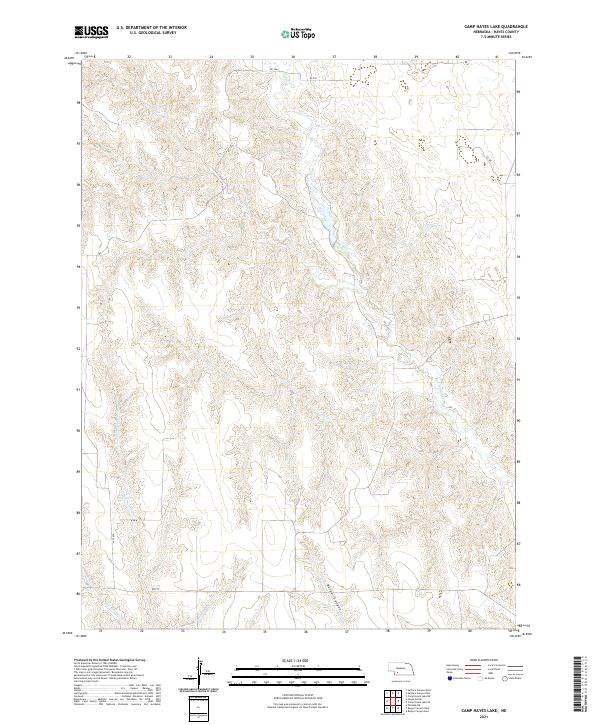
2021 Map of Camp Hayes Lake
USGS Topo · Published 2021About this map
Red Willow Cr meanders across the high plains of Hayes County in this recent survey, carving a distinct drainage pattern through the central sections of the quadrangle. The landscape is defined by its dramatic topographic relief, particularly evident along the edges of Burger Canyon and the surrounding breaks. This region of Nebraska remains characterized by its sparse settlement and extensive ranching or agricultural divisions, with travel primarily occurring along a grid of section-line roads like RD 737 and 372 Ave. Water management is a critical local feature, highlighted by the presence of the Lelker Reservoir in the southwest and several seasonal tributaries including Skunk Cr and Little Blackwood Cr. The map provides a precise look at the township and range boundaries that have dictated land use in this part of the state for over a century.
Find a feature on this map
17 named features on this map. Tap any name to fly to it.
Don’t see what you’re looking for? This feature index may not catch every label — zoom into the map to look around manually.
Map Details
Editions of this 2021 Camp Hayes Lake Map
This is the sole edition of this map. No revisions or reprints were ever made.
Other maps of this area

1954 · McCook
USGS Topo · 1:250,000

1956 · White NE
USGS Topo · 1:24,000

1957 · McCook
USGS Topo · 1:250,000

1958 · McCook
USGS Topo · 1:250,000

1970 · Burger Canyon East
USGS Topo · 1:24,000

1973 · Camp Hayes Lake SE
USGS Topo · 1:24,000

1973 · Suttlers Canyon East
USGS Topo · 1:24,000

1973 · Suttlers Canyon West
USGS Topo · 1:24,000
1973 · Burger Canyon West
USGS Topo · 1:24,000

1974 · Hayes Center
USGS Topo · 1:24,000