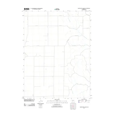
2011 Map of Camp Hayes Lake NE
USGS Topo · Published 2011About this map
North Brushy Creek and South Brushy Creek carve subtle drainage patterns across this Lincoln County landscape, defining the hydrology of a region dominated by large-scale agricultural divisions. The network of section-line roads, including W Ingham Rd and S Ash Grove Rd, reflects the rectilinear legacy of the Public Land Survey System, which continues to organize the Nebraska plains. Named for the local geography, Markee Canyon Rd provides access to the broken terrain in the east where the creeks originate. Historical transit routes are echoed in modern names like S Wagon Trail Rd, suggesting the enduring influence of early pioneer paths on the current road grid. This 2011 survey documents a sparsely populated rural area where the intersection of S Co Line Rd and S Hayes Center Rd serves as a primary navigational waypoint for residents and researchers of the high plains.
Find a feature on this map
13 named features on this map. Tap any name to fly to it.
Don’t see what you’re looking for? This feature index may not catch every label — zoom into the map to look around manually.
Map Details
Editions of this 2011 Camp Hayes Lake NE Map
This is the sole edition of this map. No revisions or reprints were ever made.
Other maps of this area

1954 · McCook
USGS Topo · 1:250,000

1956 · White NE
USGS Topo · 1:24,000

1956 · Curtis SW
USGS Topo · 1:24,000

1956 · Curtis NW
USGS Topo · 1:24,000

1956 · Dickens
USGS Topo · 1:24,000

1956 · Somerset
USGS Topo · 1:24,000

1956 · Wellfleet
USGS Topo · 1:24,000

1957 · McCook
USGS Topo · 1:250,000

1958 · McCook
USGS Topo · 1:250,000

1973 · Camp Hayes Lake SE
USGS Topo · 1:24,000