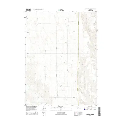
2014 Map of Camp Hayes Lake SE
USGS Topo · Published 2014About this map
Red Willow Cr and Spring Cr carve through the high plains of Southwest Nebraska, defining a landscape marked by deep drainages and a strictly rectilinear road network. This 2014 survey captures the rural boundary where Hayes and Frontier Counties meet. The terrain is notably etched by Elkhorn Canyon in the northeast, while the Teel Reservoir serves as a localized water source within this arid environment. The map details the transition from plateau to creek bottom, where various thoroughfares like Avenue 377 and Road 744 follow the Section lines of the Public Land Survey System. The infrastructure is sparse, reflecting a region dedicated to ranching and dryland farming, with the topography dictated by the winding path of Red Willow Creek.
Find a feature on this map
19 named features on this map. Tap any name to fly to it.
Don’t see what you’re looking for? This feature index may not catch every label — zoom into the map to look around manually.
Map Details
Editions of this 2014 Camp Hayes Lake SE Map
This is the sole edition of this map. No revisions or reprints were ever made.
Other maps of this area

1954 · McCook
USGS Topo · 1:250,000

1956 · White NE
USGS Topo · 1:24,000

1956 · Curtis SW
USGS Topo · 1:24,000

1956 · Curtis NW
USGS Topo · 1:24,000

1957 · McCook
USGS Topo · 1:250,000

1958 · McCook
USGS Topo · 1:250,000

1970 · Quick
USGS Topo · 1:24,000

1970 · Burger Canyon East
USGS Topo · 1:24,000

1973 · Camp Hayes Lake SE
USGS Topo · 1:24,000

1973 · Suttlers Canyon East
USGS Topo · 1:24,000