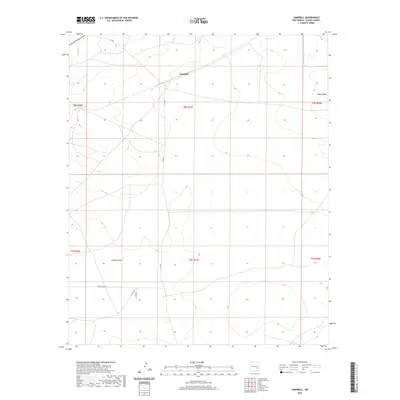
2020 Map of Campbell
USGS Topo · Published 2020About this map
Campbell occupies a central position within this Chaves County landscape, where the high desert terrain of southeastern New Mexico is defined by vast cadastral boundaries and sparse water resources. The topography is shaped by features like Palma Mesa in the northeast and the winding path of Lloyds Canyon, which cuts through the southern sections of the quadrangle. Transportation throughout this arid region relies on a network of rural routes, including Co Rd 51 and Magdalena Rd, as well as Mesilla Rd and Zanes Rd near the southwestern corner. This area’s ranching character is evidenced by isolated water points such as White Tank, which serves as a critical landmark in an otherwise dry environment. The map provides a clear view of the Public Land Survey System township and range lines, reflecting the organized division of land that defines the settlement patterns of this New Mexico territory.
Find a feature on this map
14 named features on this map. Tap any name to fly to it.
Don’t see what you’re looking for? This feature index may not catch every label — zoom into the map to look around manually.
Map Details
Editions of this 2020 Campbell Map
This is the sole edition of this map. No revisions or reprints were ever made.
Other maps of this area

1949 · Sardine Mountain
USGS Topo · 1:24,000

1949 · L-E Ranch
USGS Topo · 1:24,000

1950 · Comanche Spring
USGS Topo · 1:24,000

1955 · Roswell
USGS Topo · 1:250,000

1958 · Roswell
USGS Topo · 1:250,000

1962 · Roswell
USGS Topo · 1:250,000

1962 · Eightmile Draw
USGS Topo · 1:24,000

1962 · Acme
USGS Topo · 1:24,000
1967 · Campbell
USGS Topo · 1:24,000

1967 · Haystack Mountain
USGS Topo · 1:24,000