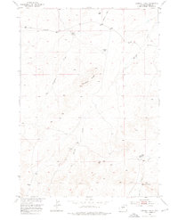
1953 Map of Campbell Ridge
USGS Topo · Published 1975About this map
Croft Ranch and Poston Ranch stand as isolated outposts in this 1950s study of the Wyoming high country, where the landscape is defined by the prominent Campbell Ridge and a network of ephemeral waterways. The drainage patterns of Dry Cheyenne Creek, Oil Springs Creek, and Conant Creek reveal the arid character of the region, while Campbell Lake provides a rare permanent water feature in the northern portion of the quadrangle. The Ohio Road serves as the primary corridor through this open range, connecting the scattered ranching operations that characterize the local economy. Published as part of the Department of the Interior's development program for the Missouri River Basin, this survey captures a specific moment in the land-use history of Fremont County, documenting the essential infrastructure of windmills and unimproved roads used by mid-century stockmen.
Find a feature on this map
10 named features on this map. Tap any name to fly to it.
Don’t see what you’re looking for? This feature index may not catch every label — zoom into the map to look around manually.
Map Details
Editions of this 1953 Campbell Ridge Map
3 editions found
Other maps of this area

1951 · Fuller Reservoir
USGS Topo · 1:24,000

1951 · Indian Butte
USGS Topo · 1:24,000

1952 · Double Butte
USGS Topo · 1:24,000

1952 · Haybarn Hill
USGS Topo · 1:24,000

1952 · Rongis Reservoir
USGS Topo · 1:24,000

1953 · Blue Gulch
USGS Topo · 1:24,000

1953 · Campbell Ridge
USGS Topo · 1:24,000

1953 · Sand Draw
USGS Topo · 1:24,000

1955 · Thermopolis
USGS Topo · 1:250,000

1955 · Arminto
USGS Topo · 1:250,000