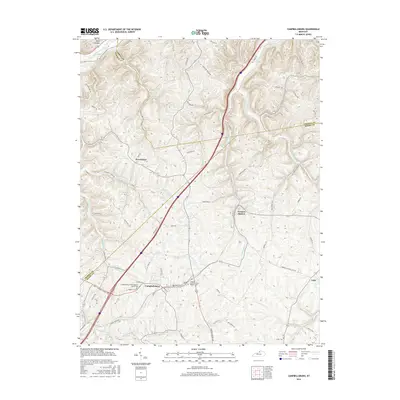
2016 Map of Campbellsburg
USGS Topo · Published 2016About this map
Campbellsburg serves as the primary hub in this portion of the northern Kentucky landscape, situated near the intersection of the Trimble and Henry County lines. The terrain is defined by a dense network of drainage, including the Little Kentucky River and White Sulphur Fork, which carve through the regional topography. Local heritage is preserved in several small communities and faith centers, such as Providence and the Sulphur Fork Primitive Baptist Cemetery. The transport network shows a clear hierarchy, where modern corridors like the Frontage Road contrast with older rural routes like Old Gilgal Road. Smaller settlements like Turners Station and Lacie anchor the eastern and southern reaches, while family names are etched into the land through features like Nilly Hollow and Mellins Branch.
Find a feature on this map
75 named features on this map. Tap any name to fly to it.
Don’t see what you’re looking for? This feature index may not catch every label — zoom into the map to look around manually.
Map Details
Editions of this 2016 Campbellsburg Map
This is the sole edition of this map. No revisions or reprints were ever made.
Other maps of this area

1928 · New Castle
USGS Topo · 1:48,000

1932 · New Castle
USGS Topo · 1:62,500

1932 · La Grange
USGS Topo · 1:62,500

1943 · Brooksburg
USGS Topo · 1:24,000

1943 · Vevay South
USGS Topo · 1:24,000

1952 · Vevay South
USGS Topo · 1:24,000

1952 · Worthville
USGS Topo · 1:24,000

1952 · Campbellsburg
USGS Topo · 1:24,000

1953 · Bedford
USGS Topo · 1:24,000

1953 · Carrollton
USGS Topo · 1:24,000