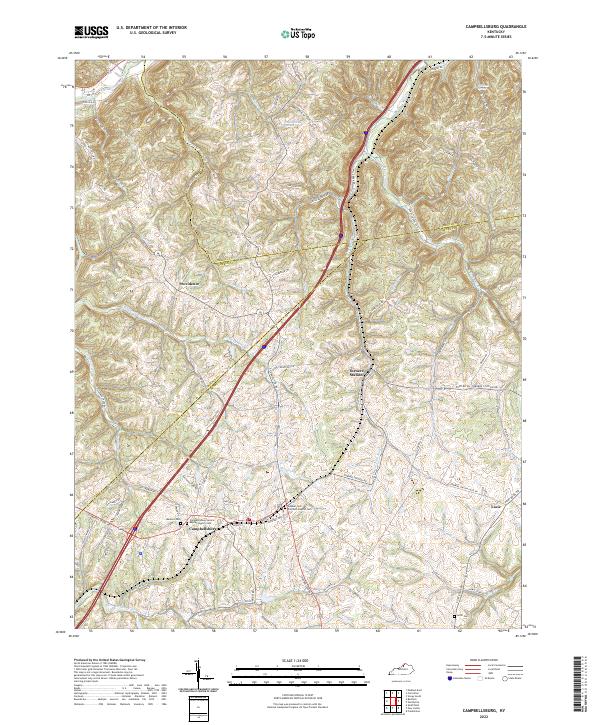
2022 Map of Campbellsburg
USGS Topo · Published 2022About this map
Campbellsburg serves as the primary hub in this corner of North Central Kentucky, situated where the CSX rail line and local thoroughfares converge. The landscape is defined by the winding course of the Little Kentucky River and Daugherty Creek, which carve through the prominent Hills that characterize the borderlands of Carroll and Henry counties. Smaller communities like Turners Station and Providence remain distinct nodes within a rural network of family-named roads and agrarian land patterns.
Find a feature on this map
86 named features on this map. Tap any name to fly to it.
Don’t see what you’re looking for? This feature index may not catch every label — zoom into the map to look around manually.
Map Details
Editions of this 2022 Campbellsburg Map
This is the sole edition of this map. No revisions or reprints were ever made.
Other maps of this area

1928 · New Castle
USGS Topo · 1:48,000

1932 · New Castle
USGS Topo · 1:62,500

1932 · La Grange
USGS Topo · 1:62,500

1943 · Brooksburg
USGS Topo · 1:24,000

1943 · Vevay South
USGS Topo · 1:24,000

1952 · Vevay South
USGS Topo · 1:24,000

1952 · Worthville
USGS Topo · 1:24,000

1952 · Campbellsburg
USGS Topo · 1:24,000

1953 · Bedford
USGS Topo · 1:24,000

1953 · Carrollton
USGS Topo · 1:24,000