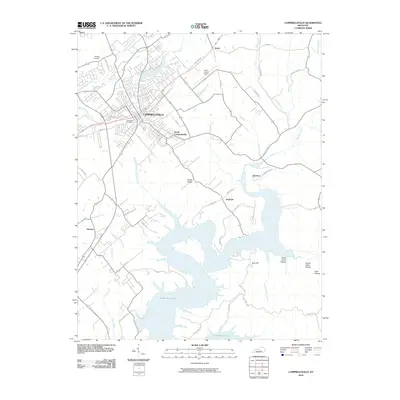
2010 Map of Campbellsville
USGS Topo · Published 2010About this map
Campbellsville serves as the central hub of this 2010 topographic study, surrounded by a complex network of waterways and developing suburban reaches. The expansion of South Campbellsville and the operational presence of the Taylor County Airport illustrate the modern infrastructure of Taylor County, while established landmarks like Brookside Cemetery and Harding Cemetery provide anchors for genealogical research. To the south, the massive footprint of Green River Lake dominates the landscape, its sprawling shoreline punctuated by named hollows such as Indian Henry Hollow and Hunter Cabin Hollow. Smaller settlements like Elk Horn, Atchison, and Hatcher are situated along the primary corridors leading away from the city center. This map reveals a transition where the urban grid of Campbellsville meets the water-rich geography of Little Pitman Creek and Trace Fork.
Find a feature on this map
50 named features on this map. Tap any name to fly to it.
Don’t see what you’re looking for? This feature index may not catch every label — zoom into the map to look around manually.
Map Details
Editions of this 2010 Campbellsville Map
This is the sole edition of this map. No revisions or reprints were ever made.
Other maps of this area

1952 · Mannsville
USGS Topo · 1:24,000

1952 · Bradfordsville
USGS Topo · 1:24,000

1953 · Campbellsville
USGS Topo · 1:24,000

1953 · Saloma
USGS Topo · 1:24,000

1953 · Gresham
USGS Topo · 1:24,000

1953 · Spurlington
USGS Topo · 1:24,000

1953 · Cane Valley
USGS Topo · 1:24,000

1953 · Bradfordsville
USGS Topo · 1:24,000

1954 · Knifley
USGS Topo · 1:24,000

1954 · Greensburg
USGS Topo · 1:24,000