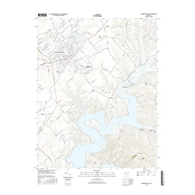
2016 Map of Campbellsville
USGS Topo · Published 2016About this map
Campbellsville serves as the central hub of this Taylor County landscape, where the urban grid and Campbellsville Univ campus meet the rugged fingers of Green River Lake. The topography is defined by the significant flooding of the Green River valley, which has created a complex shoreline of deep inlets and ridges such as Smith Ridge and Pike Ridge. Smaller settlements like Elk Horn, Atchison, and Hatcher dot the surrounding highlands, connected by a network of rural routes including New Columbia Rd and State Park Rd. Local history is anchored by sites like Brookside Cem and Harding Cem, while the Taylor County Airport and Campbellsville City Reservoir indicate the modern infrastructure supporting the region's growth.
Find a feature on this map
45 named features on this map. Tap any name to fly to it.
Don’t see what you’re looking for? This feature index may not catch every label — zoom into the map to look around manually.
Map Details
Editions of this 2016 Campbellsville Map
This is the sole edition of this map. No revisions or reprints were ever made.
Other maps of this area

1952 · Mannsville
USGS Topo · 1:24,000

1952 · Bradfordsville
USGS Topo · 1:24,000

1953 · Campbellsville
USGS Topo · 1:24,000

1953 · Saloma
USGS Topo · 1:24,000

1953 · Gresham
USGS Topo · 1:24,000

1953 · Spurlington
USGS Topo · 1:24,000

1953 · Cane Valley
USGS Topo · 1:24,000

1953 · Bradfordsville
USGS Topo · 1:24,000

1954 · Knifley
USGS Topo · 1:24,000

1954 · Greensburg
USGS Topo · 1:24,000