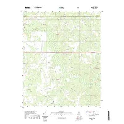
2021 Map of Canaan
USGS Topo · Published 2021About this map
Holly Springs National Forest encompasses the eastern portion of this landscape where the Wolf River meanders across the border of Mississippi and Tennessee. This 2021 survey reveals a rural territory defined by small settlements like Michigan City, Spring Hill, and Canaan, connected by a network of local roads including Hwy 72 and Old Hwy 72. The land is dotted with family and community landmarks, particularly evident in the high density of small burial grounds such as Valentine Cem, McKinzie Cem, and Samuel Chapel Cem. These sites, alongside geographic features like Robinson Bottom and Mosquito Bend, reflect a long-established pattern of upland farming and bottomland drainage. The map also records water management efforts, such as the Indian Creek Watershed Number Eight Lake, which contrast with natural watercourses like Chubby Cr and Blind Tiger Cr.
Find a feature on this map
73 named features on this map. Tap any name to fly to it.
Don’t see what you’re looking for? This feature index may not catch every label — zoom into the map to look around manually.
Map Details
Editions of this 2021 Canaan Map
This is the sole edition of this map. No revisions or reprints were ever made.
Other maps of this area

1949 · Moscow
USGS Topo · 1:62,500

1950 · Ashland
USGS Topo · 1:62,500

1950 · Grand Junction
USGS Topo · 1:24,000

1951 · Grand Junction
USGS Topo · 1:24,000

1952 · Saulsbury
USGS Topo · 1:24,000

1953 · Holly Springs
USGS Topo · 1:62,500

1956 · Blytheville
USGS Topo · 1:250,000

1956 · Tupelo
USGS Topo · 1:250,000

1958 · Tupelo
USGS Topo · 1:250,000

1959 · Blytheville
USGS Topo · 1:250,000