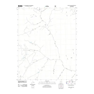
2011 Map of Canada Ojitos
USGS Topo · Published 2011About this map
Nogales Cliff House stands as a significant cultural landmark in this high-desert landscape, highlighting the archaeological depth of the region. The map reveals a network of canyons and drainages, including the prominent Cañada Ojitos and Horse Heaven Canyon, which carve through the terrain. Human activity is marked by rural outposts like Syphers Ranch and Collins Ranch, alongside industrial traces such as the Young Prospect. The presence of naming conventions like Cañoncito de las Lleguas and Canada Jose reflects a deeply rooted regional heritage. Local water features, including Laguna Simon and Laguna Seca, suggest the seasonal hydrology essential for ranching and settlement in this part of Rio Arriba County. This 2011 survey records the road network of the era, from Co RD 383 to various forest routes, providing a detailed view of the modern infrastructure overlaid on a traditional landscape.
Find a feature on this map
37 named features on this map. Tap any name to fly to it.
Don’t see what you’re looking for? This feature index may not catch every label — zoom into the map to look around manually.
Map Details
Editions of this 2011 Canada Ojitos Map
This is the sole edition of this map. No revisions or reprints were ever made.
Other maps of this area

1889 · Largo
USGS Topo · 1:250,000

1895 · Largo
USGS Topo · 1:250,000

1909 · Gallina
USGS Topo · 1:125,000

1954 · Aztec
USGS Topo · 1:250,000

1955 · Llaves
USGS Topo · 1:62,500

1955 · Boulder Lake
USGS Topo · 1:62,500

1958 · Aztec
USGS Topo · 1:250,000

1962 · Aztec
USGS Topo · 1:250,000

1963 · Lindrith
USGS Topo · 1:24,000
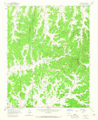
1963 · Ojito
USGS Topo · 1:24,000