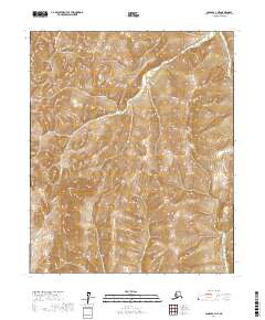
2017 Map of Candle A-1 NE
USGS Topo · Published 2017About this map
Traverse Peak stands as a central topographical anchor in this wilderness area of the Yukon-Koyukuk Census Area. The landscape is defined by the headwaters and drainage systems of the Box River and the Ungalik River, which carve through the high terrain. This 2017 survey reflects the remote character of the region, where the primary organizational markers are the established land partitions of the Public Land Survey System, including t3s r3w and t4s r2w. The absence of roads or permanent structures underscores the isolation of this interior territory, preserving a view of the land as a watershed for the Bering Sea drainage basin.
Find a feature on this map
7 named features on this map. Tap any name to fly to it.
Don’t see what you’re looking for? This feature index may not catch every label — zoom into the map to look around manually.
Map Details
Editions of this 2017 Candle A-1 NE Map
This is the sole edition of this map. No revisions or reprints were ever made.
Other maps of this area

1951 · Candle
USGS Topo · 1:250,000

1951 · Kateel River
USGS Topo · 1:250,000

1954 · Candle A-1
USGS Topo · 1:63,360

1954 · Candle B-1
USGS Topo · 1:63,360
1955 · Kateel River A-6
USGS Topo · 1:63,360
1955 · Kateel River B-6
USGS Topo · 1:63,360

1955 · Kateel River
USGS Topo · 1:250,000

1955 · Candle
USGS Topo · 1:250,000

1964 · Candle
USGS Topo · 1:250,000
2015 · Candle B-1 SE
USGS Topo · 1:25,000