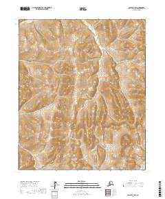
2017 Map of Candle A-1 NW
USGS Topo · Published 2017About this map
Inglutalik River and Ungalik River drain a high-elevation interior landscape within the Yukon-Koyukuk Census Area. This region is defined by its dramatic topographic relief, where numerous unnamed ridges rise above 1,000 feet, separated by deeply incised drainage basins. The map illustrates the headwaters and tributaries of these significant waterways, showing the complex watershed patterns in a part of Alaska where natural physical boundaries dictate the land's organization. The survey covers portions of four townships, including t3s r4w, t3s r3w, t4s r4w, and t4s r3w, documenting the precise elevation contours of the territory as they stood in the early twenty-first century.
Find a feature on this map
6 named features on this map. Tap any name to fly to it.
Don’t see what you’re looking for? This feature index may not catch every label — zoom into the map to look around manually.
Map Details
Editions of this 2017 Candle A-1 NW Map
This is the sole edition of this map. No revisions or reprints were ever made.
Other maps of this area

1951 · Candle
USGS Topo · 1:250,000

1954 · Candle A-2
USGS Topo · 1:63,360

1954 · Candle A-1
USGS Topo · 1:63,360

1954 · Candle B-2
USGS Topo · 1:63,360

1954 · Candle B-1
USGS Topo · 1:63,360

1955 · Candle
USGS Topo · 1:250,000

1955 · Candle A-2
USGS Topo · 1:63,360

1964 · Candle
USGS Topo · 1:250,000
2015 · Candle B-2 SE
USGS Topo · 1:25,000
2015 · Candle B-1 SE
USGS Topo · 1:25,000