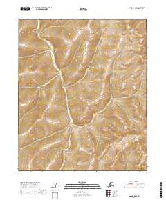
2017 Map of Candle A-2 SW
USGS Topo · Published 2017About this map
Township and Range boundaries define the organizational structure of this landscape within the Nome Census Area. The terrain is characterized by a complex system of drainage and relief, delineated by the Public Land Survey System grids including t5s r6w and t4s r6w. While no specific settlements or landmarks are named on this sheet, the map provides a technical layout of the regional geography as it was recorded during the 2010s. The survey reflects the contemporary administrative divisions and topography of this interior portion of the Seward Peninsula, documented through datasets from the Bureau of Land Management and the National Hydrography Dataset.
Find a feature on this map
9 named features on this map. Tap any name to fly to it.
Don’t see what you’re looking for? This feature index may not catch every label — zoom into the map to look around manually.
Map Details
Editions of this 2017 Candle A-2 SW Map
This is the sole edition of this map. No revisions or reprints were ever made.
Other maps of this area

1948 · Norton Bay
USGS Topo · 1:250,000

1950 · Norton Bay D-3
USGS Topo · 1:63,360

1951 · Candle
USGS Topo · 1:250,000

1951 · Norton Bay
USGS Topo · 1:250,000

1954 · Candle A-2
USGS Topo · 1:63,360

1954 · Norton Bay D-2
USGS Topo · 1:63,360

1955 · Candle
USGS Topo · 1:250,000

1955 · Norton Bay
USGS Topo · 1:250,000

1955 · Candle A-2
USGS Topo · 1:63,360

1964 · Candle
USGS Topo · 1:250,000