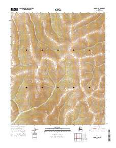
2014 Map of Candle A-3 SE
USGS Topo · Published 2014About this map
Garryowen Cr winds through the southwestern corner of this survey, defining the drainage pattern of a terrain marked by dramatic elevation changes. The land is organized by the Public Land Survey System, with boundaries such as t5s r8w and t5s r7w clearly delineated across the high ridges and deep valleys. These township and range lines reveal the underlying geometric structure imposed on the Alaskan wilderness, where the natural flow of water and the rigid lines of historical surveying meet in an unpopulated landscape.
Find a feature on this map
7 named features on this map. Tap any name to fly to it.
Don’t see what you’re looking for? This feature index may not catch every label — zoom into the map to look around manually.
Map Details
Editions of this 2014 Candle A-3 SE Map
This is the sole edition of this map. No revisions or reprints were ever made.
Other maps of this area

1948 · Norton Bay
USGS Topo · 1:250,000

1950 · Norton Bay D-3
USGS Topo · 1:63,360

1951 · Candle
USGS Topo · 1:250,000

1951 · Norton Bay
USGS Topo · 1:250,000

1954 · Candle A-2
USGS Topo · 1:63,360

1954 · Norton Bay D-2
USGS Topo · 1:63,360

1955 · Candle
USGS Topo · 1:250,000

1955 · Norton Bay
USGS Topo · 1:250,000

1955 · Candle A-2
USGS Topo · 1:63,360

1964 · Candle
USGS Topo · 1:250,000