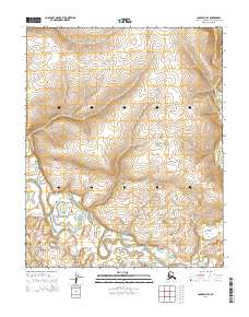
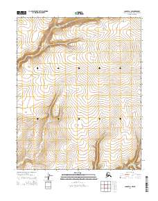
2014 Map of Candle D-3 SE
USGS Topo · Published 2014About this map
The Buckland River meanders across the southern reach of this Northwest Arctic landscape, forming a complex network of oxbows and river bends. This high-latitude environment is defined by the convergence of several significant watercourses, including the N Fork Buckland River and the smaller Brush Cr tributary. The terrain is marked by the distinct absence of roads or permanent settlements, reflecting the remote character of the region within the Northwest Arctic Borough. The topographic data highlights the intricate drainage patterns of the river valley as it cuts through the surrounding uplands, providing a clear picture of the hydrological structure of this subarctic wilderness in the early twenty-first century.
Find a feature on this map
12 named features on this map. Tap any name to fly to it.
Don’t see what you’re looking for? This feature index may not catch every label — zoom into the map to look around manually.
Map Details
Editions of this 2014 Candle D-3 SE Map
This is the sole edition of this map. No revisions or reprints were ever made.
Other maps of this area

1951 · Candle
USGS Topo · 1:250,000

1954 · Candle C-2
USGS Topo · 1:63,360

1954 · Candle D-2
USGS Topo · 1:63,360

1955 · Candle
USGS Topo · 1:250,000

1955 · Candle C-3
USGS Topo · 1:63,360
1955 · Candle D-3
USGS Topo · 1:63,360

1964 · Candle
USGS Topo · 1:250,000
2014 · Candle D-3 SW
USGS Topo · 1:25,000
2014 · Candle C-3 NE
USGS Topo · 1:25,000
2014 · Candle D-2 NW
USGS Topo · 1:25,000