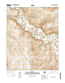
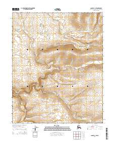
2014 Map of Candle D-3 SW
USGS Topo · Published 2014About this map
The Buckland River dominates this Arctic landscape, winding through the tundra of the Northwest Arctic Borough. The river’s intricate meanders and oxbows suggest a low-gradient floodplain where water shapes the land over centuries. To the north, the Fish River joins the drainage system, while Brush Cr cuts through the southeastern corner, illustrating the complex hydrography of the Alaskan interior. This survey by the U.S. Geological Survey provides a clear view of the Public Land Survey System grid, including boundaries for t5n r8w and t6n r9w, which are essential for navigating and cataloging this remote terrain. The absence of roads or permanent settlements in this 2014 data highlights the preserved, wild character of the region, where topographical features like elevation contours from the National Elevation Dataset define the only landmarks.
Find a feature on this map
9 named features on this map. Tap any name to fly to it.
Don’t see what you’re looking for? This feature index may not catch every label — zoom into the map to look around manually.
Map Details
Editions of this 2014 Candle D-3 SW Map
This is the sole edition of this map. No revisions or reprints were ever made.
Other maps of this area

1951 · Candle
USGS Topo · 1:250,000

1955 · Candle
USGS Topo · 1:250,000

1955 · Candle D-4
USGS Topo · 1:63,360

1955 · Candle C-4
USGS Topo · 1:63,360

1955 · Candle C-3
USGS Topo · 1:63,360
1955 · Candle D-3
USGS Topo · 1:63,360

1964 · Candle
USGS Topo · 1:250,000
2014 · Candle C-3 NE
USGS Topo · 1:25,000
2014 · Candle D-4 NE
USGS Topo · 1:25,000
2014 · Candle D-3 NW
USGS Topo · 1:25,000