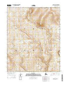
2014 Map of Candle D-4 NE
USGS Topo · Published 2014About this map
Harvey Creek and Pack Sack Creek carve a series of drainages through the Northwest Arctic landscape, defining the topography of this corner of Alaska. The area is marked by a clear grid of township and range boundaries, including t7n r10w, t7n r9w, t6n r10w, and t6n r9w. These watercourses flow through a largely unpopulated terrain, typical of the Seward Peninsula interior where seasonal mining and subsistence activities traditionally shaped land use. The map illustrates the hydrological patterns that have guided navigation and resource exploration in the region for decades.
Find a feature on this map
6 named features on this map. Tap any name to fly to it.
Don’t see what you’re looking for? This feature index may not catch every label — zoom into the map to look around manually.
Map Details
Editions of this 2014 Candle D-4 NE Map
This is the sole edition of this map. No revisions or reprints were ever made.
Other maps of this area

1951 · Candle
USGS Topo · 1:250,000

1951 · Selawik
USGS Topo · 1:250,000

1955 · Candle
USGS Topo · 1:250,000

1955 · Selawik A-4
USGS Topo · 1:63,360

1955 · Candle D-4
USGS Topo · 1:63,360
1955 · Candle D-3
USGS Topo · 1:63,360

1955 · Selawik A-3
USGS Topo · 1:63,360

1957 · Selawik
USGS Topo · 1:250,000

1964 · Candle
USGS Topo · 1:250,000
2014 · Candle D-3 SW
USGS Topo · 1:25,000