
1955 Map of Selawik A-3
USGS Topo · Published 1968About this map
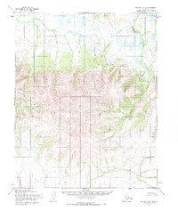
The Selawik Hills dominate the southern half of this landscape, rising above a vast system of meandering waterways and tundra pools in the northern flats. Based on aerial photography and field annotations from the mid-1950s, the map reveals a remote terrain where water defines the passage through the land. The Manyluk River winds through the northeast corner, while the Kauk River and Lomen Creek drain the north-central area. The Kateel River Meridian serves as the surveying baseline here, though the margin notes that land lines represent unsurveyed and unmarked locations predetermined by the Bureau of Land Management. This lack of roads or established trails highlights the wilderness character of the region during this era, where traditional travel likely followed these prominent watercourses.
Find a feature on this map
4 named features on this map. Tap any name to fly to it.
Don’t see what you’re looking for? This feature index may not catch every label — zoom into the map to look around manually.
Map Details
Editions of this 1955 Selawik A-3 Map
2 editions found
Other maps of this area

1951 · Candle
USGS Topo · 1:250,000

1951 · Selawik
USGS Topo · 1:250,000

1954 · Candle D-2
USGS Topo · 1:63,360

1955 · Candle
USGS Topo · 1:250,000

1955 · Selawik A-4
USGS Topo · 1:63,360

1955 · Candle D-4
USGS Topo · 1:63,360

1955 · Selawik B-3
USGS Topo · 1:63,360
1955 · Candle D-3
USGS Topo · 1:63,360

1955 · Selawik B-4
USGS Topo · 1:63,360

1957 · Selawik
USGS Topo · 1:250,000