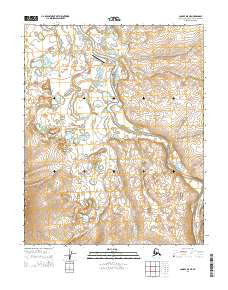
2014 Map of Candle D-5 NE
USGS Topo · Published 2014About this map
Buckland sits at the northern edge of this Arctic survey, concentrated near a bend in the Buckland River. The settlement infrastructure is clearly delineated, showing the Po and the local transit network including Audrey Avenue and Airport Road leading to the Buckland Airport. The surrounding landscape is defined by a dense network of watercourses and wetlands, with the meandering river joined by numerous tributaries such as Kanik Cr, Keeyuk Cr, and Fairhaven Cr. This 2014 data reflects the modern footprint of the community, including the Landfill Access road, providing a detailed record of remote habitation and transportation in the Northwest Arctic Borough. The terrain beyond the village quickly shifts to undeveloped tundra marked by minor drainages like Koobuk Cr and Canyon Cr.
Find a feature on this map
16 named features on this map. Tap any name to fly to it.
Don’t see what you’re looking for? This feature index may not catch every label — zoom into the map to look around manually.
Map Details
Editions of this 2014 Candle D-5 NE Map
This is the sole edition of this map. No revisions or reprints were ever made.
Other maps of this area

1951 · Candle
USGS Topo · 1:250,000

1951 · Selawik
USGS Topo · 1:250,000

1951 · Candle D-5
USGS Topo · 1:63,360

1951 · Selawik A-5
USGS Topo · 1:63,360

1955 · Candle
USGS Topo · 1:250,000

1955 · Selawik A-4
USGS Topo · 1:63,360

1955 · Candle D-4
USGS Topo · 1:63,360

1957 · Selawik
USGS Topo · 1:250,000

1964 · Candle
USGS Topo · 1:250,000
2014 · Selawik A-4 SW
USGS Topo · 1:25,000