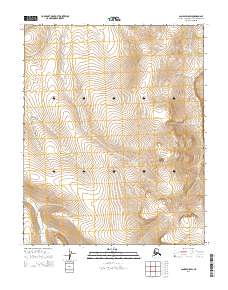
2014 Map of Candle D-5 SW
USGS Topo · Published 2014About this map
Sugar Top rises as a prominent landmark in this segment of the Northwest Arctic borough, anchoring a landscape defined by the drainage patterns of the Duck Cr and Hunter Cr systems. This 2014 survey documents the remote terrain within the Public Land Survey System grids, specifically tracing the headwaters and tributaries like Left Fork Hunter Cr. The map provides a clear record of the area's hydrology and topography just before the middle of the 2010s, reflecting a wilderness region characterized by high-elevation peaks and winding creek beds. For those studying the geography of this part of Alaska, the map illustrates the precise relationship between the designated townships and the natural contours of the land.
Find a feature on this map
11 named features on this map. Tap any name to fly to it.
Don’t see what you’re looking for? This feature index may not catch every label — zoom into the map to look around manually.
Map Details
Editions of this 2014 Candle D-5 SW Map
This is the sole edition of this map. No revisions or reprints were ever made.
Other maps of this area

1950 · Candle C-5
USGS Topo · 1:63,360

1950 · Candle C-6
USGS Topo · 1:63,360

1951 · Candle
USGS Topo · 1:250,000

1951 · Candle D-5
USGS Topo · 1:63,360

1951 · Candle D-6
USGS Topo · 1:63,360

1955 · Candle
USGS Topo · 1:250,000

1964 · Candle
USGS Topo · 1:250,000
2014 · Candle C-5 NW
USGS Topo · 1:25,000
2014 · Candle C-5 NE
USGS Topo · 1:25,000
2014 · Candle D-6 NE
USGS Topo · 1:25,000