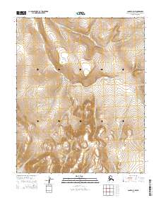
2014 Map of Candle C-5 NW
USGS Topo · Published 2014About this map
High-latitude hydrology and the shifting drainage of the Seward Peninsula characterize this interior landscape. The intricate network of the Hunter Cr watershed dominates the terrain, with several of its primary tributaries including the Left Fork Hunter Cr and Spruce Cr carving through the high country. These watercourses are critical markers for the region's historical placer mining potential and early 20th-century exploration corridors. The map provides a precise layout of the Public Land Survey System grid, specifically within the boundaries of t4n r14w and t3n r13w. These townships and ranges are essential for tracing land claims and prospecting sites in the remote reaches of the Northwest Arctic Borough. Further south, the headwaters of Wasp Cr and Buck Cr define the local topography, offering a clear view of the natural boundaries that once guided foot travel and resource extraction.
Find a feature on this map
10 named features on this map. Tap any name to fly to it.
Don’t see what you’re looking for? This feature index may not catch every label — zoom into the map to look around manually.
Map Details
Editions of this 2014 Candle C-5 NW Map
This is the sole edition of this map. No revisions or reprints were ever made.
Other maps of this area

1950 · Candle C-5
USGS Topo · 1:63,360

1950 · Candle C-6
USGS Topo · 1:63,360

1951 · Candle
USGS Topo · 1:250,000

1951 · Candle D-5
USGS Topo · 1:63,360

1951 · Candle D-6
USGS Topo · 1:63,360

1955 · Candle
USGS Topo · 1:250,000

1964 · Candle
USGS Topo · 1:250,000
2014 · Candle C-5 NE
USGS Topo · 1:25,000
2014 · Candle D-6 SE
USGS Topo · 1:25,000
2014 · Candle C-6 SE
USGS Topo · 1:25,000