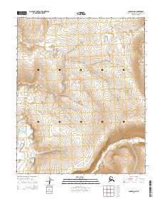
2014 Map of Candle D-6 SE
USGS Topo · Published 2014About this map
Lava Cr winds through the center of this terrain in the Northwest Arctic Borough, cutting across the township boundaries of T5N R14W and T5N R15W. This 2014 survey captures a remote subarctic landscape defined by significant elevation changes, with ridges rising between the drainages of Wabash Cr in the northwest and Hunter Cr in the southeast. The map provides precise topographic detail of the ridgelines and valley floors, showing the intricate contouring of the Seward Peninsula interior before it reaches the coast. These watercourses are the primary geographical markers in an area devoid of permanent road infrastructure or named settlements, illustrating the drainage patterns that dominate this high-latitude wilderness.
Find a feature on this map
9 named features on this map. Tap any name to fly to it.
Don’t see what you’re looking for? This feature index may not catch every label — zoom into the map to look around manually.
Map Details
Editions of this 2014 Candle D-6 SE Map
This is the sole edition of this map. No revisions or reprints were ever made.
Other maps of this area

1950 · Candle C-5
USGS Topo · 1:63,360

1950 · Candle C-6
USGS Topo · 1:63,360

1951 · Candle
USGS Topo · 1:250,000

1951 · Candle D-5
USGS Topo · 1:63,360

1951 · Candle D-6
USGS Topo · 1:63,360

1955 · Candle
USGS Topo · 1:250,000

1964 · Candle
USGS Topo · 1:250,000
2014 · Candle C-5 NW
USGS Topo · 1:25,000
2014 · Candle D-6 NE
USGS Topo · 1:25,000
2014 · Candle C-6 NW
USGS Topo · 1:25,000