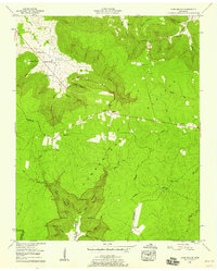
1956 Map of Cane Hollow
USGS Topo · Published 1958About this map
Cumberland Plateau topography dominates this mid-century survey, where the Tennessee Valley Divide snakes across the high ground between Hubbard Cove and the deeply incised valleys to the south. The landscape is defined by its dramatic relief, from the sharp descent at Flatbench Point to the secluded drainage of Northcutts Cove. Small rural communities and family landmarks are clustered primarily along the northern shelf and valley floors, connected by the winding route of Tennessee 108.
Find a feature on this map
59 named features on this map. Tap any name to fly to it.
Don’t see what you’re looking for? This feature index may not catch every label — zoom into the map to look around manually.
Map Details
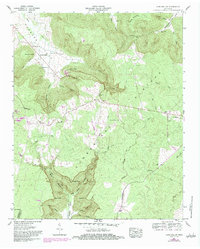
Editions of this 1956 Cane Hollow Map
2 editions found
Other maps of this area

1893 · Mc Minnville
USGS Topo · 1:125,000

1895 · Mc Minnville
USGS Topo · 1:125,000

1895 · Sewanee
USGS Topo · 1:125,000

1936 · Alto
USGS Topo · 1:24,000

1936 · Burrow Cove
USGS Topo · 1:24,000

1936 · Tracy City
USGS Topo · 1:24,000

1936 · Morrison
USGS Topo · 1:24,000

1936 · Hillsboro
USGS Topo · 1:24,000

1936 · Cane Hollow
USGS Topo · 1:24,000

1943 · Mc Minnville
USGS Topo · 1:100,000