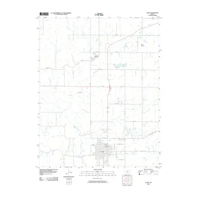
2009 Map of Caney
USGS Topo · Published 2009About this map
Caney anchors this landscape in southeastern Kansas, situated at the confluence of several local waterways including the Little Caney River and Mud Creek. This 2009 survey shows a well-defined grid in the town center, extending out to the Caney Airpark and the northern reaches of the community toward Sunny Side Cemetery. To the north, the smaller settlement of Havana sits near the shores of Havana Lake, a landscape punctuated by the elevation of Round Mound. The map reveals a robust rural infrastructure defined by an extensive county road system, such as Tyro Cutoff Rd and Traveler Rd, which connect the scattered homesteads and agricultural plots. The drainage patterns of Bee Creek, Coon Creek, and Cheyenne Creek illustrate the natural topography that has influenced the placement of these Kansas settlements and their transportation corridors over more than a century of development.
Find a feature on this map
39 named features on this map. Tap any name to fly to it.
Don’t see what you’re looking for? This feature index may not catch every label — zoom into the map to look around manually.
Map Details
Editions of this 2009 Caney Map
This is the sole edition of this map. No revisions or reprints were ever made.
Other maps of this area

1885 · Sedan
USGS Topo · 1:125,000

1886 · Independence
USGS Topo · 1:125,000

1889 · Sedan
USGS Topo · 1:125,000

1894 · Independence
USGS Topo · 1:125,000

1901 · Nowata
USGS Topo · 1:125,000

1905 · Independence
USGS Topo · 1:125,000

1909 · Pawhuska
USGS Topo · 1:125,000

1910 · Pawhuska
USGS Topo · 1:125,000

1914 · Nowata
USGS Topo · 1:125,000

1947 · Joplin
USGS Topo · 1:250,000